Via Crispi Naples: I Have a 1923 Photograph and the Street Looks Identical Today
Via Crispi, Naples: I Have a 1923 Photograph and the Street Looks Identical Today
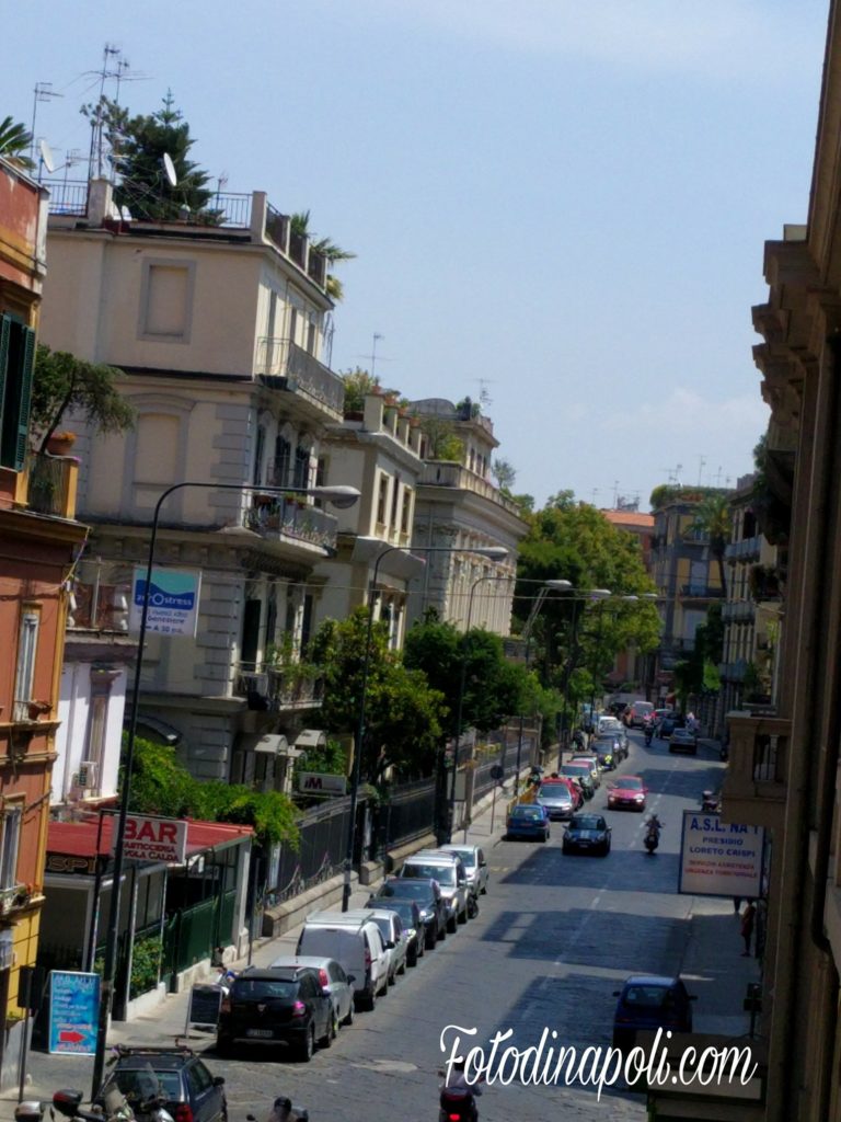
I have a photograph of Via Crispi taken in 1923. The year is written on the back in faded pencil, in handwriting that belongs to a different era. The photograph shows a street that I can walk today and recognise in almost every detail: the proportion of the buildings, the rhythm of the shopfronts at street level, the specific way the road curves slightly where it approaches the Chiaia waterfront junction. The cars parked along it are different. The signage on the shops is different. The clothes on the people are different. The street is the same.
This is remarkable in Naples, which demolished enormous sections of its historic centre in the late 19th century during therisanamento— the sanitation programme that cleared the overcrowded medieval city and replaced it with wide new boulevards — and which has continued, in various ways, to transform its built environment in every decade since. Via Crispi was left alone. Here is why.
Why This Street Survived When Others Didn’t
Therisanamentothat reshaped central Naples from the 1880s onwards was geographically targeted: it focused on the dense, overcrowded, medieval districts around the port and the historic centre. The new demolitions created Corso Umberto I and the surrounding blocks. Via Crispi runs along the Chiaia waterfront — outside the demolition zone, in a neighbourhood where property ownership was concentrated in families with both the financial resources and the legal connections to resist compulsory purchase.
The result is a street that feels, in its proportions and its materials and its architectural rhythm, like a preserved sample of a Naples that otherwise exists only in historical photographs and in occasional surviving doorways and facades embedded in later construction. The buildings are late 19th and very early 20th century — Neapolitan residential blocks in the Liberty era, the Italian inflection of art nouveau, with details that subsequent construction abandoned: decorative stucco at window height, varied iron balcony railings, terracotta floor tiles visible through ground-floor shop windows, entrance halls with mosaic floors.
What to Look At
The facades repay slow attention. The balcony railings along this street are all different — each building had its own ironworker, its own commission, its own specific decorative language. The window surrounds vary in a way that mass production later made impossible. At street level, some shops maintain interiors that feel similarly preserved: a pharmacy with original mahogany fittings behind the counter, a bar with floor tiling from the 1950s at the most recent, an entrance hall whose mosaic still functions as the floor of a building that has otherwise been completely modernised above it.
The photography challenge here is knowing whether to include the modern elements — brand signage, current vehicle models, people looking at phones — or to try to isolate the historical. My position, developed over multiple visits: include them. A photograph that removes the modern elements illustrates a past that doesn’t exist. A photograph that includes both the 1920s facade and the 2026 Vespa parked in front of it documents something true about how the city actually contains its own history. The best time for this: early morning, when vehicle density is low and the light comes from the east and lands on the upper facades before reaching street level.
Practical Notes 2026
Via Crispi runs between Via Partenope (the seafront) and the Chiaia district. Five minutes on foot from Piazza Amedeo metro station (Line 2). Naturally combined with a walk along the Chiaia waterfront and the Borgo Marinari harbour below Castel dell’Ovo. All within a 20-minute circuit.